Saturday, June 20, 2009

Home Sweet Home


Today was the last stretch of our trip; we experienced some overnight showers at our campsite in central New York state, but avoided rain and even saw some sunlight on our way home today. Overall, our weather in the past three weeks hasn't been as fair as it could have been, but at every step of the way we seemed to be just ahead of or just behind the worst of it --- no complaints!

Unpacking and cleaning a motorhome can be a daunting task, but it's great to be home. Having said that, there is a part of us that already misses life "on the road"; we're already talking about possibilities for our next trip!

In the mean time, thanks for following our blog!

"THE END" for now!
Friday, June 19, 2009

Yours Till Niagara Falls.....


We've spent the last few days visiting family and friends in the mid-west; good times but not too much site-seeing to report on.
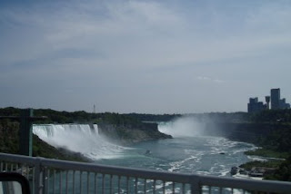
Today, we took the Canadian route out of Michigan, which had us re-entering the U.S. across the Rainbow Bridge at Niagara Falls. Neither of us had been to the Falls since the mid-1970's. For me, it brought to mind three random and unrelated thoughts about Niagara:

(1) Thomas Cole, often considered to be the father of the Hudson River School of Art, painted an interpretation of Niagara around 1830; the original is on display at Vermont's own National Park (Marsh-Billings-Rockefeller) in Woodstock. The painting portrays a placid scene, but even in Cole's day, the true view would have included hotels and tourist traps, not too different than today.

(2) I remember reading years ago that among other daredevils to survive a ride over the Falls, there was one named "Jean Lussier" of Massachusetts (no known relation) who did so in a large rubber ball. See http://adventure.howstuffworks.com/niagara8.htm or GOOGLE "Jean Lussier Niagara" for more information.

(3) Of course, who can forget the 1950's Marilyn Monroe / Joseph Cotton film titled "Niagara"? Apparently not the Niagara Falls souveneir shops that now sell DVD copies!

Wednesday, June 17, 2009

Enjoying the Scenery


Yesterday was an uninterrupted 450 mile stretch to get to the Chicago area; a great day to just sit back and enjoy the scenery.

Iowa farmland:

Mississippi River:

Indiana farmland:


.... and the name of a town in Iowa that says it all:

Monday, June 15, 2009

The Cornhusker and Hawkeye (and Corn Dog) States


Today was a day focused on adding eastbound mileage, and not so much on seeing the sights. Still, we have to pay tribute to the Cornhusker state with a couple of pictures of, well....corn fields.

We reached Iowa in mid-afternoon.

Unable to photograph a "Hawkeye" (see dictionary definitions at http://dictionary.reference.com/browse/hawkeye), here instead are pictures of the Iowa welcome sign and some windmills along the I-80 west of Des Moines.


Sunday, June 14, 2009

East of the Continental Divide


Yesterday, we crossed the Continental Divide in Rocky Mountain National Park; we're back to where all streams and rivers flow into the Atlantic Ocean.
Today, we said good-bye to all of those mountains and mesas, and drove out of the Rockies and into the Great Plains.

We took an unplanned detour into Cheyenne Wyoming and serendipitously came upon the old Union Pacific train station and a chili festival.


Cheyenne's got some great old architecture; the train station neighborhood appears to be on its way to more restoration:


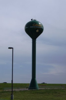
From there eastward, it was nothing but plains and wide-open views. We discovered a previously unknown (to us) factoid along the way: Sidney, Nebraska (population 6200+)is the world-wide headquarters for Cabella's.
It also turns out that the old Oregon Trail paralleled what is now I-80 in parts of Nebraska - how fortuitous for those pioneers to have had a Cabella's along the way! :-)

Saturday, June 13, 2009

Rocky Mountain National Park

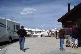
RMNP boasts the highest point of any highway in the U.S......an altitude of 12,183 feet.

There's not much more we can say about the scenery; there is still plenty of snow at the summits of the 12,000+ footers.

RVing Advantages


There are many advantages to RV travel; here are two: (1) Never having to wait in line for restrooms (and the potential of charging for use of our facilities as a means of funding our trip)

(2) Having lunch at our favorite 11,000+ foot restaurant.

Friday, June 12, 2009

And Now for Something Completely Different


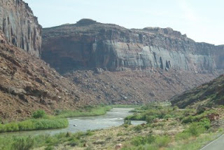
We left Moab this morning and took scenic Route 128 out to I-70, starting our way back eastward. Route 128 follows the Colorado River along the "back" side of Arches National Park.


Continuing into the state of Colorado we roughly followed the river all along I-70. The stretch of interstate in Glenwood Canyon is so narrow that the westbound lanes are built to overlap the eastbound lanes.


Our final destination was a town named Kremmling (population 1,500, elevation 7,000+), in the highlands west of Rocky Mountain National Park. This is definitely cattle country, the terrain being what we like to call "high chaparall". We're surrounded by rolling green hills and views of snow-covered peaks, and are spending the evening sheltered in our motor home from temperatures in the 50's and high winds.


The Colorado River's source is up near Rocky Mountain National Park, which is our destination tomorrow. Although we haven't made it a point of doing so, we realize now that an interesting and varied motor trip would be to follow the Colorado River from its source to where it drains into the Gulf of California: http://encarta.msn.com/map_701510605/colorado.html

Thursday, June 11, 2009

Still More Rocks

We're in Moab, Utah for a second night. Moab is a center for a variety of outdoor activities - hiking, 4x4-ing, mountain biking, rafting, etc., and the center of town is loaded with businesses supporting those endevors.

More importantly for us, Moab is just a few miles from two national parks - Arches and Canyonlands - and we did both today.


Arches National Parks is another one of those wonders with landscapes completely unlike anything we have in the East.


"Delicate Arch" is famously recognized and has become the unofficial trademark for the state of Utah; the above picture was taken from a lookout point; if you double click on it to see the full screen version, you'll get an idea of the proportions by observing the tiny specs of people standing near it.


This formation is known as "The Three Gossips". While I don't particularly like the title, you can almost see three pioneer women in bonnets and long skirts.

Canyonlands National Park is perhaps a little less known than Arches. If the pictures are reminiscent of every western movie ever made, there's a reason for it - Canyonlands has been the set for a number of films. In addition, it served at times as the hiding place for the real Butch Cassidy and his gang: the inhospitable canyons provided a convenient haven from law enforcement.


Wednesday, June 10, 2009

More Rocks


We had decided that we'd taken enough pictures of rocks to last the rest of the trip - how many more interesting rock formations could there be in Utah after Zion and Bryce National Parks? Then we started on our way eastward out of Torrey Utah and drove through Capital Reef National Park. Capital Reef isn't one of the more well-known national parks, but it provides an interesting drive through what's called a "waterpocket fold" in the earth's surface (see www.nps.gov/care); it also includes a historic Mormon homestead from the 1800's.
The weather was on-and-off cloudy with intermittent showers; although not the best for picture taking, we managed to find plenty of subjects. However, our WiFi connection this evening is very poor, so I will have to dispense with loading any more pictures for now and will wait until after we visit Arches and Canyonlands National Parks tomorrow.
By the way, our friend Jerry keeps reminding that by double-clicking on any of the posted pictures, you will be able to view the photo in full-screen mode (to return to the blog after doing so, hit the browser "Back" button).

Tuesday, June 9, 2009

More of Utah


John says I'm possessed, but it's not my fault that I've taken over 80 pictures today --- he's the one that bought me that digital camera in the first place, and he's the one driving to all of these absolutely incredible places!
Today, it was more of Utah: we visited Bryce Canyon National Park and then drove along Utah highway 12, which borders Grand Staircase Escalante National Monument and Dixie National Forest.


This is a natural formation, and not a picture of a castle ruin or old fortress:

And this rock surface even has a smiling face! :-)

Monday, June 8, 2009

Another Day, Another National Park


Today it was Zion National Park - surprisingly VERY busy for a Monday. Perhaps it has to do with the fact that the park is celebrating its 100th anniversary this year (it was declared a National Monument on July 31, 1909, and became a national park in 1919). The Zion Canyon portion of the park was closed to private vehicles in 2000 due to excessive traffic; instead, the Park Service provides continuous free shuttles up the canyon road with multiple stopping points along the way.

We took the shuttle up to the end and hiked the River Walk trail, an easy 2 mile round trip. Of special interest are the "hanging gardens" along the walk - although the climate is generally dry, the rock walls along the trails "weep" water, providing a rock foothold for a variety of plants.

Another interesting points about Zion: "Butch Cassidy and the Sundance Kid" was partially filmed in this park in 1968.


An observation: from the time we reached the greater Four Corners area last weekend, we've noticed an inordinate amount of foreign travelers, many touring the west via RV's rented from companies such as RVAmerica, CruiseAmerica, and others. To be more specific, the RV renters are typically Europeans (our neighbors at Monument Valley on Friday night were two couples from the Netherlands), while the Oriental visitors usually travel by bus.